The first time I walked through Tiong Bahru, I got it completely wrong.
I came for the coffee. Everyone told me to. So I sat in a bright little cafe on Eng Hoon Street, ordered a flat white that cost more than my usual breakfast, and thought, “This is it? This is what people talk about?”
I left underwhelmed. It took me a second visit, and an old uncle at the market, to realise I had been reading the neighbourhood backwards.
He was buying pork for lunch, same stall on Seng Poh Road he had used for forty years, he said. When I asked him about the “hipster” area, he laughed. Not unkindly. Then he pointed at the curved white blocks across the road and told me people used to be buried where those flats now stand.
That stopped me.
So if you are coming to Tiong Bahru for the first time, let me save you the mistake I made. The trendy cafes are fine. But the real story here is older, quieter, and far more worth your time. This is a walk through Tiong Bahru heritage that starts long before anyone thought to sell you a croissant.
Tiong Bahru History: What the Name Actually Means
Here is something most visitors never learn.
The name itself tells you the whole story. “Tiong” is the Hokkien word linked to cemetery. “Bahru” is the Malay word for new. New cemetery. That was what this place was before it became anything else.
I remember standing there after the uncle told me, feeling a little foolish. I had walked past those words on street signs, along Tiong Bahru Road, Tiong Poh Road, Boon Tiong Road, dozens of times, and never once wondered what they meant.
The land was a burial ground first. Kampong Tiong Bahru, as the area was once known, only later became something for the living. That layering, death then life, old then new, runs underneath everything you will see here. Keep it in mind as you walk. It changes how the whole place feels.
Chua Seah Neo and the Stories Behind the Streets
Not many people know the name Chua Seah Neo when they visit. But she belongs to the older human story of this estate.
She was among the community figures tied to the early settlement of Kampong Tiong Bahru, part of the network of merchants, landowners, and families, including Hokkien businessmen like Seah Eu Chin, who shaped the social fabric of this part of Singapore long before the Singapore Improvement Trust arrived with blueprints and building contracts.
The streets here carry those histories quietly. Eu Chin Street, Kim Pong Road, Kim Tian Road, Chay Yan Street, they are not just addresses. They are names that once meant something to the families who lived and traded here. I find it worth pausing on that for a moment before you rush toward the architecture.
Development of Tiong Bahru: Singapore’s First Public Housing Estate (And Why It Wasn’t HDB)
Let me clear up a mistake I hear all the time, one I used to make myself.
People call Tiong Bahru “Singapore’s oldest HDB estate.” It is not. HDB did not exist yet.
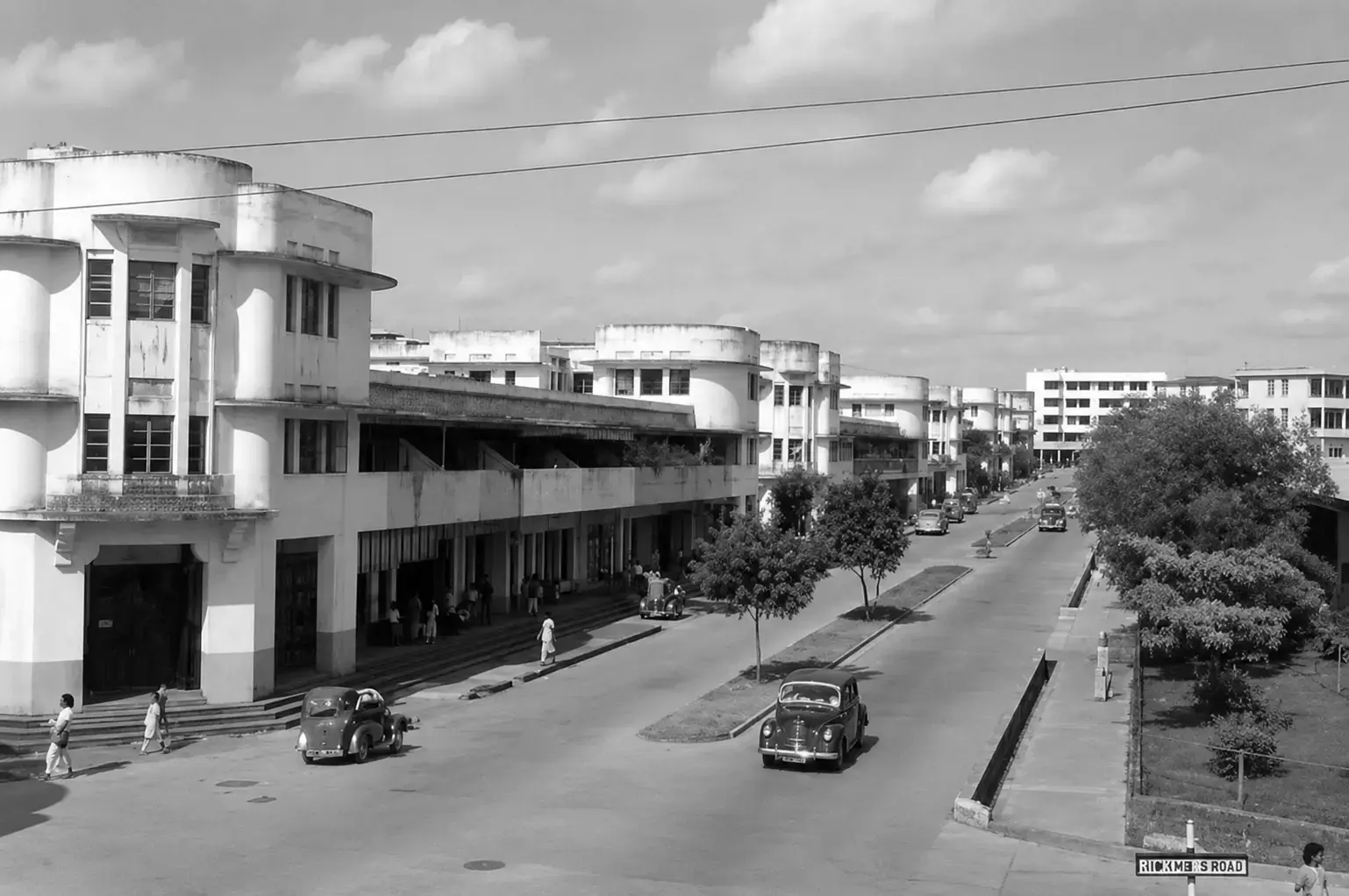
The development of Tiong Bahru was led by the Singapore Improvement Trust, or SIT, the colonial body that came before HDB. Between 1937 and 1941, SIT built 784 flats, 54 tenements, and 33 shops across this public housing estate. These are the only surviving SIT flats from that pre-war scheme anywhere in Singapore.
That detail matters more than it sounds. When you stand in front of these blocks along Lim Liak Road or Moh Guan Terrace, you are looking at the very beginning of public housing in this country. Everything that followed, the HDB towns most of us grew up in, traces its roots back to this modest experiment.
The National Heritage Board and the National Library Board have both documented this thoroughly, and I would recommend reading their resources if you want the full picture before you visit.
Heritage Insights: If you want to sound like you actually understand Tiong Bahru history, never say HDB. Say SIT. The people who live here will notice, and it shows you did your reading.
Design of Tiong Bahru: The Architecture Nobody Tells You to Notice
On my first visit, I spent the whole time looking at menus. On my second, I finally looked up.
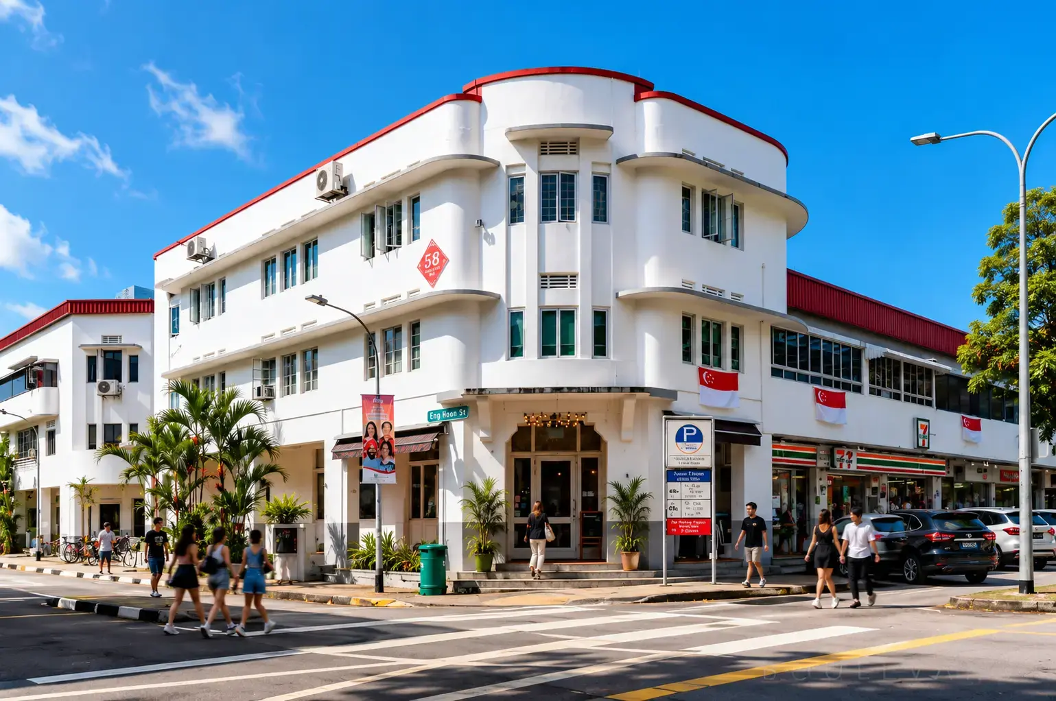
The design of Tiong Bahru’s pre-war flats follows a style called Streamline Moderne, a late cousin of Art Deco architecture. The architect Alfred G. Church shaped much of it. Once you know what to look for, you cannot unsee it.
Notice the curved balconies that wrap around corners like the deck of a ship. The long horizontal lines. The flat roofs. The rounded edges. In the 1930s, this was the future. Clean, modern, forward-looking, a deliberate break from the crowded shophouses of old Singapore.
The Urban Redevelopment Authority granted conservation status to 20 blocks in the estate in 2003, which means these buildings are not going anywhere. Standing on Moh Guan Terrace and just looking up for a few minutes is something I would genuinely recommend.
Trail tip: Morning light hits the curved facades beautifully around 8:30 to 9am. If you care about photos of the architecture, this is your window. Not of residents. Of buildings.
Public Housing, War, and the Ground Beneath Your Feet
Here is the part that gave me goosebumps.
The public housing estate was built on the eve of World War II. And the SIT flats were designed with that tension in mind. At Block 78 on Guan Chuan Street sits Singapore’s first communal civilian air raid shelter built into a residential estate. When the blocks went up, they included a place for ordinary families to hide from the bombs during an air raid.
You need a guided tour to access it (My Community runs one that includes it), but even standing outside, knowing it is there, changes how you see the block. These were not just homes. They were shelter in the most literal sense.
I think this is the moment Tiong Bahru stops being pretty and starts being real. People lived here through the war. They raised children, buried loved ones, and hid underground when the sirens sounded. That weight is still in the walls.
The proximity of Pearl’s Hill, the old Outram Road, and what is now Singapore General Hospital adds another layer. This part of Singapore carried hospitals, prisons, cemeteries, and housing all within walking distance of each other. The density of history here is quietly staggering.
Housing Estate Culture and the Birth of Singapore’s Hawker Centre Tradition
This is the connection I wish someone had explained to me sooner.
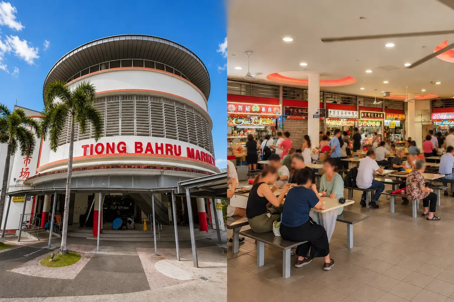
When SIT built these flats, they did something quietly revolutionary. They gathered people into a planned housing estate, and those communities needed to eat. The market and its food stalls were not an afterthought. They were part of how the neighbourhood was designed to function.
That model, housing and hawker centre side by side, became the blueprint for how Singapore fed itself as it modernised. Every HDB town that followed carried a version of it. The hawker centre downstairs from your flat. The kopitiam where you know the drinks uncle by face. The shared tables where you learn to “chope” a seat with a packet of tissues.
Tiong Bahru showed that food could be woven into the fabric of everyday living. When you eat at the market today, on Seng Poh Road or in the hawker centre upstairs, you are tasting the start of that idea.
The recipes have been passed down. The uncle frying your carrot cake may be the second or third generation to do it in that exact spot. That continuity is rare, and it is precious.
The Tiong Bahru Bird Corner: A Living Piece of the Old Neighbourhood
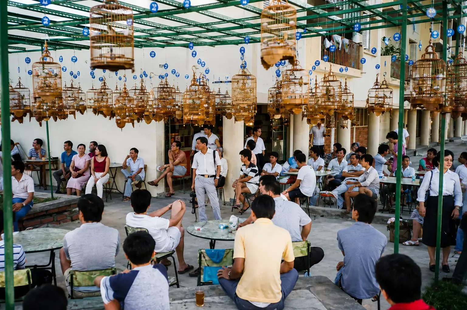
Not everything in Tiong Bahru is architecture or hawker stalls. The bird corner is one of those living traditions that many first-timers walk right past.
On weekend mornings, usually along the shophouses near Tiong Bahru Road, you can find older men gathering with their songbirds in rattan cages, hanging them at eye level, letting the birds sing to each other in competition. This is the Tiong Bahru bird corner, and it has been part of the social life here for decades.
It is not a tourist attraction. There are no signs. You just have to be there early enough and know to look.
I found it by accident on a Sunday, trailing a group of elderly men in slippers carrying cages, wondering where they were headed. What I found was one of the most genuinely local scenes I have seen anywhere in Singapore. No charge. No commentary. Just tradition, still alive in the middle of a very changed city.
Monkey God Temple and the Spiritual Landscape of the Estate
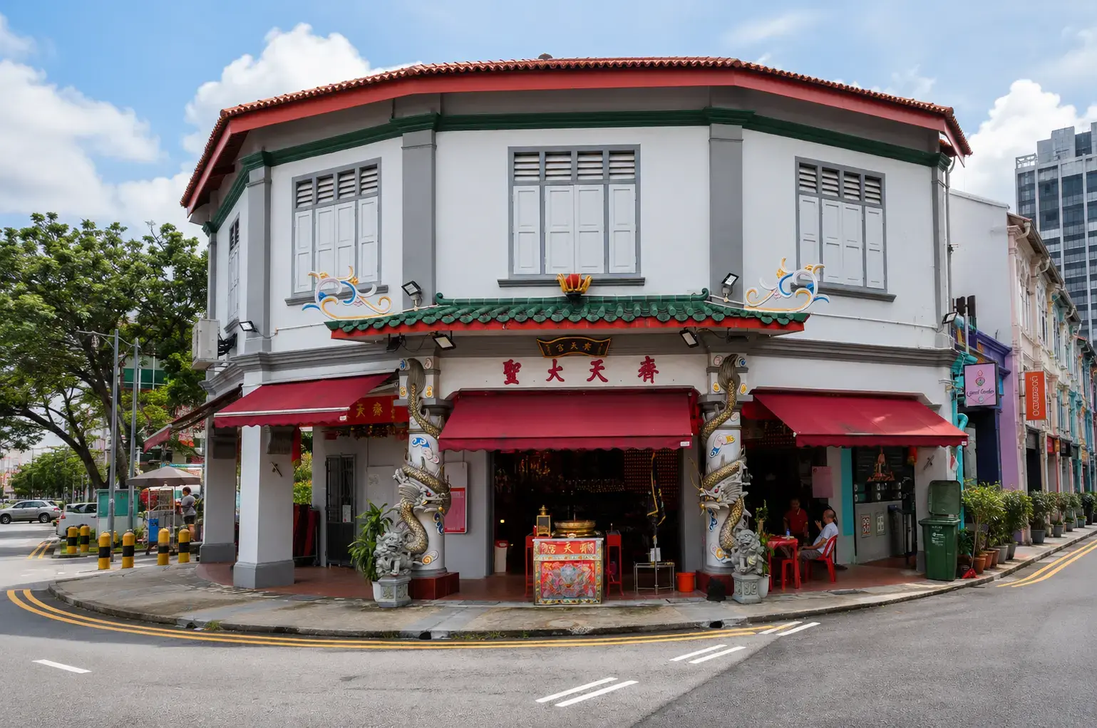
Singapore’s public housing estates have always made space for religion alongside daily life, and Tiong Bahru is no exception.
The Monkey God Temple, dedicated to the Monkey King (or Sun Wukong) from Chinese mythology, sits within the estate as a reminder that the community here has always been deeply rooted in its cultural and spiritual traditions. This god temple is a Taoist temple dedicated to a deity that many in the Hokkien and Teochew communities hold in reverence.
Walking past it, you will often see offerings on the ground floor, incense smoke drifting out, and elderly worshippers going about their visits with quiet routine. It is not a museum. It is still very much in use.
Near it, and equally worth knowing about, are other Chinese temples and the Hu Lu Temple, which has its own story attached to the land and community here.
Former Hu Lu Temple and the Sacred Sites Hidden in Plain Sight
The former Hu Lu Temple (or the gourd temple as some translate it) is one of the less-discussed heritage sites in Tiong Bahru, but it belongs to the same layered spiritual geography that makes this estate so distinctive.
Many of the older Chinese temples and Taoist shrines in the estate predate the SIT flats. They sat on the land before the housing was built, and in several cases, the SIT and later authorities worked around them or incorporated them into the estate’s fabric. That negotiation between modern public housing projects and older sacred spaces is itself a piece of Singapore history that rarely makes it into the travel blogs.
If you visit, take a moment at these sites. Not as a tourist looking for content, but as someone trying to understand what the community here believed in and still believes in.
Community Centre, Seng Poh Garden, and the Living Neighbourhood
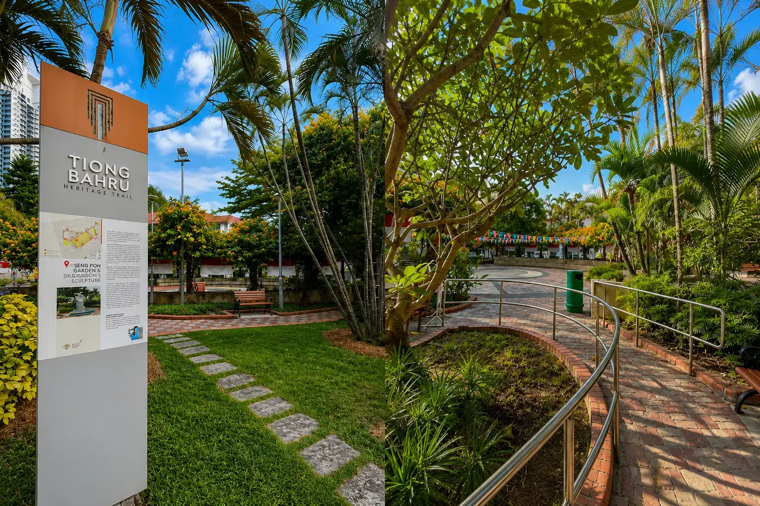
Tiong Bahru’s identity was never just built from bricks and flats. The Tiong Bahru community centre has been part of keeping the neighbourhood alive as a functioning social space for residents across generations.
Seng Poh Garden, along Seng Poh Road, is another quiet piece of that fabric. It is not a grand park. It is a neighbourhood garden, the kind where older residents sit in the morning, where children cut through on their way home, where life happens without anyone documenting it.
This is what a housing estate actually is, not a collection of buildings, but a shared way of living. The Tiong Bahru community understood that early, and the spatial design of the estate, with its curved corridors, sheltered walkways, and communal ground-floor spaces, was built to encourage exactly that kind of everyday contact.
Walking It Yourself: The Honest Practical Guide
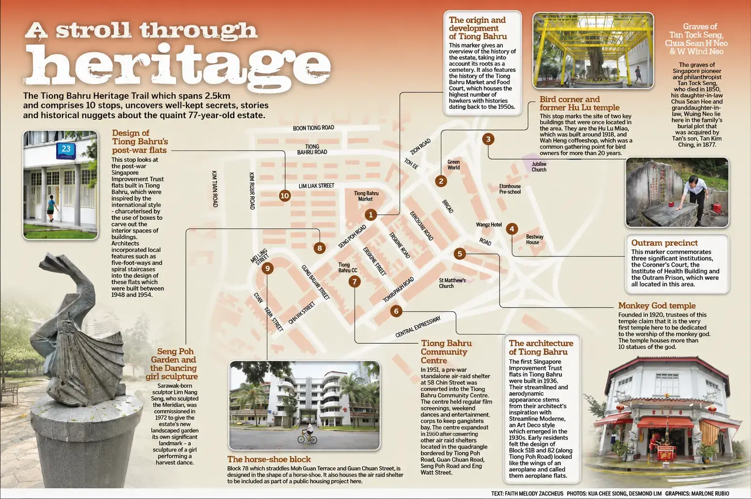
You do not need a paid tour. The Tiong Bahru heritage trail, managed by the National Heritage Board, is self-guided, with storyboards and mapped stops along the way.
Where to start: Tiong Bahru Market and Food Centre on Seng Poh Road. It’s worth arriving early to enjoy breakfast; our guide to the best food and must-try dishes at Tiong Bahru Food Centre can help you decide where to eat before exploring the estate.
The route: From the market, wander toward Eng Hoon Street, Guan Chuan Street, Moh Guan Terrace, and Tiong Poh Road. The full trail runs about 2.5 km with 10 stops.
Getting there: Tiong Bahru MRT Station on the East-West Line is your easiest entry point. From the station, it is about a five-minute walk to the market. You can also come from the Outram Park complex if you are connecting from the North-East or Thomson-East Coast Line.
Time needed: Around 1 to 1.5 hours for the walk itself. Add another hour if you are eating properly and stopping to actually read the storyboards (which you should).
Best time to go: Between 8am and 10am. The market is alive, the weather is bearable, and the bird corner may be active if it is a weekend. Come at noon and you will be sweaty, hungry, and fighting for a table.
What to bring: Water, cash for the stalls, comfortable shoes, and an umbrella. A small portable fan would not hurt either.
Pro tip: Read the storyboards. They explain the cemetery origins, the SIT housing story, and the community history in a way the flats alone cannot. This is where the trail actually teaches you something.
Real people live here. These flats are not museum exhibits. Keep your voice down near the residential blocks. Do not block entrances. Do not photograph residents without asking. Treat it with the same respect you would want if strangers were wandering past your own front door.
A Few Last Thoughts Before You Go
I went back to Tiong Bahru many times after that second visit. I still get coffee sometimes at Tiong Bahru Bakery, no shame in that. But now I sit with the weight of the place. The burial ground that came first. The kampong that followed. The SIT flats that turned it into Singapore’s first real public housing estate. The air raid shelter under Block 78. The bird corner on a Sunday morning. The Monkey God Temple still receiving visitors.
Tiong Bahru heritage rewards the person who slows down. Come for a walk, not a checklist. Eat where the aunties eat. Look up at the curved balconies and imagine 1938. Let the layers reveal themselves.
You will leave with more than photos. You will leave with a small piece of how Singapore became Singapore.
And if you enjoyed this, come read more with us at Singapore Hawkers, where we keep telling the stories behind the food and the places that hold them.